
Erlangen – a Planned City
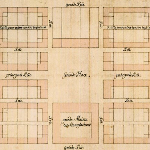 Ideal layout of the New Town
Draft by Margravial Master Builder Johann Moritz Richter (1647–1705)
Ink wash drawing, 1686
This image does not show the plan in its original orientation. For better readability, some street names have been rotated by 180 degrees.
Erlangen's New Town is one of the few 17th-century planned urban developments in Germany. The original design envisages a rectangular, symmetrical layout whose proportions are governed by 'ideal measurements' (1000 shoes) and the golden ratio. All private and public buildings fit into the town's geometric layout, which covers a mere 307 x 385 meters.
This idealised plan was only realised after an unexpectedly long construction period, and by making many concessions. With the construction of the Margravial Palace (1700–1704) and the establishment of the palace gardens, for instance, the original building programme for the area east of the main square was largely abandoned. At the same time, growth was put on a new trajectory, transverse to the Hauptstraße ('Main Street') and towards the east, which gave direction to expansion taking place in the 18th century. Towards the north, the New Town soon merged with the Old Town, whereby the original western, and particularly the southern boundaries, were crossed. The historic town centre today comprises an area many times larger than that of the building complex planned in 1686.
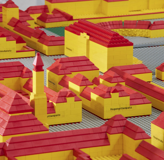
Model of Erlangen's New Town
Scale approx. 1: 285
This Lego model can be set up in two different ways. The first variation reconstructs the town as it was originally planned according to the ideal version represented by the 1686 drawing, the second shows the actual built environment as it existed in 1822.
< Previous chapter | Next chapter >